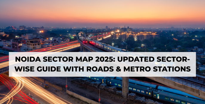
Noida Sector Map 2025 – Metro & Road Connectivity
Noida's growth is still one of its biggest strengths. In a city where everything is divided by sector, knowing where things are located makes everyday life easier. For people moving in, starting a business, or commuting across town, a map of Noida sector-wise is necessary.
Roads have expanded, and the way people traverse the city has changed. Having a clear picture of which sector connects to what helps reduce confusion and supports faster decisions in 2025.
Quick Overview – Noida Sector Map 2025
| Total Sectors | 200+ Sectors (Residential + Commercial + Institutional) |
| Main Metro Lines | Blue Line & Aqua Line |
| Top Residential Sectors | 137, 150, 75, 76, 77, 93 |
| Major Roads | Noida-GN Expressway, FNG, DND Flyway, Dadri Road |
| Best Commercial Zones | Sector 62, 63, 18, 16 |
| Best Connectivity Areas | Sector 52 Interchange, Botanical Garden, Sector 137 |
Map of Noida Sector-Wise - 2025 Overview
Noida has always followed a numbered sector layout, planned with clear zoning for housing, business, and public services. This structure remains the same in 2025, but the contents of each sector have changed. New construction, better roads, and public facilities have reshaped daily life. The city is divided into:
- Residential sectors like 50, 61, 76, and 137
- Office and institutional sectors like 62, 63, and 125
- Mixed-use zones such as 75, 77, and 78
By now, even smaller sectors have defined roles. This gives clarity to people who are house-hunting, opening a shop, or setting up an office. Using the Noida sector map saves time when planning anything across the city.
Key Sectors in 2025 - What's Important?
Some sectors have become high-interest zones in 2025 because of location as well as ease of access. Here is what you must know about the map of Noida sector-wise.
- Sector 62: Known for IT parks and colleges
- Sector 137: Popular for mid-range housing and directly connected to the Aqua Line
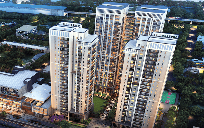
- Sector 150: Gained attention for its green space and premium housing
- Sector 75: Balanced mix of schools, homes, and market areas
People living here also benefit from better road and metro access compared to older pockets of the city.
Noida Sector-Wise Map 2025: Roads, Metro & Key Highlights
| Sector | Category / Purpose | Metro Connectivity | Major Roads & Expressways | Key Highlights |
|---|---|---|---|---|
| Sector 62 | IT Parks, Colleges, Offices | Noida Sector 62 (Blue Line) | NH-24, Dadri Main Road | Educational hub, corporate offices, direct Delhi access |
| Sector 137 | Mid-Range Housing | Sector 137 Metro (Aqua Line) | Greater Noida Expressway | Popular with families & IT professionals |
| Sector 150 | Premium Housing, Green Zone | Sector 148 Metro (Aqua Line) | Noida - Greater Noida Expressway | Luxury apartments, eco-friendly, sports facilities |
| Sector 75 | Mixed-Use: Schools, Homes, Markets | Sector 50/51 Metro (Blue & Aqua Line) | Link Road, Dadri Road | Balanced lifestyle with housing + retail |
| Sector 93 & 94 | Upscale Housing & IT Parks | Sector 83 Metro (Aqua Line) | Greater Noida Expressway | Premium apartments, high investment value |
| Sector 16, 18 | Commercial, Malls, Offices | Sector 16 Metro (Blue Line) | DND Flyway, NH-9 | Noida's shopping & entertainment hub |
| Sector 71 | Upcoming Residential Hotspot | Proposed Blue Line Extension | FNG Expressway, Link Road | Fast-developing with new underpasses |
Updated Noida Road Network - Major Routes and Connectivity
Noida's road system has always been one of its strong points. In 2025, many key stretches have been improved to manage traffic flow and reduce bottlenecks. Listed are the important road developments that can be found in the Noida sector map.
- Widening of the Greater Noida Expressway for smoother movement
- Elevated links near Sector 60 as well as Sector 52
- New underpasses in sectors like 71 and 142
Areas once difficult to reach are now directly accessible, which adds value to nearby property.
Key Arterial Roads Across Sectors
Certain roads define sector boundaries and connect one area to another. These are helpful when people are checking routes to commute.
- The Greater Noida Expressway connects sectors like 93 as well as 94
- The Dadri Main Road connects sectors 62 and 63 to nearby industrial zones
- The FNG Expressway links eastern sectors to Ghaziabad as well as Faridabad
- The Link Road helps people in sectors like 51, 52, and 71 reach the Delhi border quickly
These roads are not just highways but daily-use routes that improve access between major points in Noida.
Access to Delhi and Ghaziabad
The primary reason people choose Noida is its connection to Delhi and Ghaziabad. Here is what you should know.
- DND Flyway connects Delhi with sectors 15, 16, and 18
- NH-9 and NH-24 offer easy access to Indirapuram as well as Vaishali
- The Chilla elevated corridor (underway) will reduce travel time to central Delhi
This borderless movement keeps Noida attractive to daily travelers and long-term residents.
Noida Metro Connectivity - Blue Line & Aqua Line Sector-Wise Guide
Noida's metro system is more than just transport. In 2025, it will help people choose where to live or work. The Blue Line and Aqua Line cover the city in a way that supports both old and new sectors.
Metro access now plays a major role in local planning, property pricing, and even retail footfall.
Noida Blue Line Metro Map - Sector Coverage
The Noida Blue Line Metro Map runs across the western part of the city and connects directly to Delhi. In 2025, it continues to serve sectors that need daily movement to and from the capital. It covers:
- Sector 15 to Sector 62
- Major stops at Sector 16, 18, 34, 39, 52
- Interchange access at Sector 52 with the Aqua Line
The Blue Line remains the standard route for office-goers and students. It reduces traffic pressure on roads and makes public transport predictable. New extensions are being considered to connect it with sectors like 71 and 121.
Aqua Line Metro Map - Sector-Wise Access
The Aqua Line connects sectors that are deeper into Noida and Greater Noida. In 2025, it will support many housing sectors that have grown fast over the past few years. The covered sectors include:
- Sector 51 to Depot Station
- Helpful to areas not covered by the Blue Line
People living in Sector 137 and Sector 83 benefit the most as these stations are located right near major housing clusters. The Aqua Line reduces travel time to offices located along the expressway and nearby tech parks.
Interchange Stations and Future Metro Expansion (2025)
Metro interchanges allow users to switch between lines without confusion or delay. In Noida, these are being expanded to improve the city's movement in 2025. The important interchanges are:
- Botanical Garden: Connects Blue and Magenta Lines
- Sector 52: Connects Blue and Aqua Lines via a footbridge
- Proposed new interchange: Sector 142 (under discussion)
Future metro plans may add feeder routes and orbital lines, which will support sectors currently not on either line. These changes are meant to reduce road congestion and increase metro use in outer sectors.
Final Thoughts: Why a Sector-Wise Map of Noida is Crucial in 2025
Life in Noida depends on planning. The map of Noida sector-wise in 2025 gives residents and visitors an edge in choosing the right place to live, work, or travel. With clear routes, defined zones, and improved metro services, the Noida sector map helps everyone stay organised.
The Noida Blue Line Metro Map adds more value by connecting key sectors to Delhi and central Noida. In a growing city like this, an updated sector-wise map is not optional; it's a guide.
FAQ – Noida Sector Map 2025
1. Which is the best sector to live in Noida in 2025?
The best residential sectors include 137, 150, 75, 76, 93, and 77 due to metro access, greenery, and modern housing.
The best residential sectors include 137, 150, 75, 76, 93, and 77 due to metro access, greenery, and modern housing.
2. How does the Noida Sector Map help homebuyers?
It helps identify sector zoning, metro routes, road networks, and investment potential for selecting the right location.
It helps identify sector zoning, metro routes, road networks, and investment potential for selecting the right location.
3. Which metro lines run through Noida?
The Blue Line and Aqua Line will cover all major sectors of Noida in 2025.
The Blue Line and Aqua Line will cover all major sectors of Noida in 2025.
4. Which sectors are best for IT professionals?
Sectors 62, 63, 125, and 137 are ideal due to proximity to IT parks and metro stations.
Sectors 62, 63, 125, and 137 are ideal due to proximity to IT parks and metro stations.
5. What are the premium housing sectors in Noida?
Sectors 93, 94, 150, and 151A are top choices for luxury housing.
Sectors 93, 94, 150, and 151A are top choices for luxury housing.
6. What is the best commercial sector in Noida?
Sector 18 is Noida’s top retail hub, while Sector 62 is best for IT and office spaces.
Sector 18 is Noida’s top retail hub, while Sector 62 is best for IT and office spaces.
7. Does the metro increase real estate value in Noida?
Yes, proximity to metro stations significantly boosts housing demand and appreciation.
Yes, proximity to metro stations significantly boosts housing demand and appreciation.
8. Which sectors have the fastest road connectivity?
Sectors near DND, Expressway, and FNG — especially 15, 16, 18, 137, 150 — have superior road networks.
Sectors near DND, Expressway, and FNG — especially 15, 16, 18, 137, 150 — have superior road networks.
9. Which sectors are developing rapidly in 2025?
Sectors 71, 142, and 121 are three rapidly rising hotspots with new housing and commercial projects.
Sectors 71, 142, and 121 are three rapidly rising hotspots with new housing and commercial projects.
10. Is Noida safe for families?
Yes, Noida’s planned sectors, gated societies, schools, and metro access make it safe and family-friendly.
Yes, Noida’s planned sectors, gated societies, schools, and metro access make it safe and family-friendly.
Search Blog
- Maple Apartment
- Hibiscus Apartment
- Marigold Apartment
- Cosmos Apartment A*B
- Cosmos Apartment C
- Camellia Apartment B&C
- Camellia Apartment E
- Camellia Apartment A
Our Properties
Recent Posts


Is Buying Flats Safe In Chattarpur?
21 Sep 2023