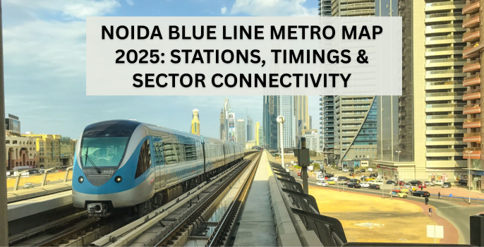
Noida Blue Line Metro Map 2025: Stations, Timings & Sector Connectivity
The metro network in Noida has changed how people move across the city. What once took hours in traffic is now covered in minutes. With new sectors developing quickly, efficient public transport is no longer a luxury. It's a need.
Among all metro lines in Noida, the Blue Line plays a key role in linking major residential and office areas. It forms the backbone of the cross-sector movement. If you're looking at a map of Noida sector-wise, you'll notice how crucial this line has become in daily life.
Quick Overview - Noida Blue Line Metro Map 2025
| Factor | Details |
|---|---|
| Route | Noida City Centre - Noida Electronic City (via Sector 34, 52, 61, 59, 62) |
| Total Stations (2025) | 12 operational, 4 upcoming (Sector 142, 143, 144, 150) |
| Key Interchange | Botanical Garden (Blue Line - Magenta Line) |
| Timings | First train: 6:00 AM | Last train: 11:20 PM |
| Frequency | Every 5 mins (peak), 9-10 mins (off-peak) |
Overview of the Noida Blue Line Metro in 2025
The Blue Line connects Noida with Delhi while covering many sectors within Noida itself. It runs parallel to densely populated zones. The corridor connects directly to the Delhi Metro network. This makes intercity travel seamless.
The Blue Line offers deeper penetration into the older as well as newer sectors than the Aqua Line. This route is part of the everyday rhythm for people working or living in Sector 50 as well as Sector 62.
The line passes through mixed zones. It connects residential colonies, tech parks, markets, and institutional blocks. With expansion plans rolling out, it's set to cover even more of Noida's urban sprawl by 2025.
Complete List of Noida Blue Line Metro Stations (2025 Update)
Here are the main operational stations as per the Noida Blue Line Metro map.
- Noida City Centre
- Sector 34
- Sector 52
- Sector 61
- Sector 59
- Sector 62
- Noida Electronic City
- Botanical Garden (Interchange)
- Golf Course
These stations handle numerous daily passengers.
Google Map - Noida Blue Line Metro Starting Point
Start your journey from Noida City Centre Metro Station, the first stop on the Noida Blue Line Metro, and connect seamlessly across key Noida sectors.
Upcoming Extensions Planned for Completion
- Sector 142
- Sector 143
- Sector 144
- Sector 150
The metro extension will reduce the reliance on private transport. The Noida sector map will also change with the expansion of the metro.
Blue Line Metro Timings & Frequency
| Station Name | First Train | Last Train | Avg. Frequency (Peak) | Avg. Frequency (Off-Peak) |
|---|---|---|---|---|
| Noida City Centre | 6:00 AM | 11:15 PM | Five minutes | Ten minutes |
| Sector 61 | 6:05 AM | 11:10 PM | Five minutes | Ten minutes |
| Electronic City | 6:10 AM | 11:00 PM | Five minutes | Ten minutes |
| Botanical Garden | 6:00 AM | 11:20 PM | Five minutes | Nine minutes |
Listed is the travel time between major stations.
- Noida City Centre to Botanical Garden: Twelve minutes
- Sector 61 to Sector 18: Ten minutes
- Botanical Garden to Electronic City: Fifteen minutes
Morning office-goers benefit from a higher frequency during peak hours. The waiting time rarely crosses 7 minutes during rush hours.
Map of Noida Sector-Wise - Connectivity through the Blue Line
Noida's sectors have grown in pockets. Some sectors are residential, while others are entirely mixed. The Blue Line passes through these zones and creates a reliable transport backbone across sectors.
Sector 62, for instance, is full of IT parks and educational institutes. Sector 50 is mostly residential. Sector 18 is the retail and commercial centre. Sectors 34 and 59 house mixed-use buildings. All of these are connected by the Blue Line. The map of Noida sector-wise depicts the effectiveness of the Blue Line.
The route is suitable for working professionals as well as tourists. It touches the central parts of Noida where things actually happen, whether it's commerce or community life.
Residential & Commercial Sectors Near Blue Line Stations
Stations like Sector 50 and Sector 61 are solid picks if you are planning to live near the metro. Residential sectors around these areas have apartments with decent occupancy rates. These apartments have easy access to essential amenities, too.
Commercially, sectors like 62, 16, and 18 benefit the most. They have office parks, co-working spaces, showrooms, and retail chains that rely on high footfall. The Blue Line directly supports this flow. Office spaces in Electronic City, as well as Sector 62, are gaining prominence as they are close to the metro.
Popular Landmarks Connected via Blue Line
The Noida sector map shows that the following destinations across Noida lie close to Blue Line stations.
- DLF Mall of India (near Sector 18)
- Botanical Garden (public park + interchange hub)
- Kailash Hospital (near Sector 27)
- Amity University (short cab ride from Botanical Garden)
- Atta Market (walkable from Sector 18)
- Logix City Centre Mall (next to Noida City Centre)
These are not just names on a board. They are everyday places that draw huge crowds. Be it students, shoppers, or families, the Blue Line is often the easiest way to reach them.
Smart Travel Tips for Noida Blue Line Users
To make your metro experience smoother, consider getting a DMRC or NMRC card. They save time and offer discounts compared to buying single tokens every day. For route planning or fare estimation, the “Delhi Metro Rail†app is reliable.
Avoid boarding the metro in the peak morning hours. Travelling 30 minutes before or after these windows makes a big difference.
Try boarding from the last coach (if you're at the station's tail end). It's usually less crowded. Also, keep your luggage minimal and headphones ready. It makes even longer rides peaceful.
Final Thoughts on the Noida Blue Line Metro Map 2025
The Blue Line continues to shape how Noida travels. From new housing clusters to corporate blocks, the impact is visible across daily life. Whether you're looking for a flat, heading to work, or shopping for groceries, the Blue Line probably plays a part in how you get there. It's reliable and connects the places that matter most.
If you refer to the Noida sector map, it's easy to see how deeply this line links people and zones. And with upcoming stations in growing sectors like 142 and 150, it's only becoming more useful. In short, the Noida Blue Line Metro map is part of the city's rhythm. A look at any map of Noida sector-wise will prove just how central it has become.
Frequently Asked Questions about Noida Blue Line Metro Map 2025
1. What is the Noida Blue Line Metro Map 2025?
The Noida Blue Line Metro Map 2025 highlights the updated route from Noida City Centre to Noida Electronic City. It includes key stations like Sector 34, 52, 61, 59, 62, and Botanical Garden. If you look at the map of Noida sector-wise, you’ll see how this line connects important residential and commercial zones.
2. How many stations are there on the Noida Blue Line Metro in 2025?
According to the Noida sector map, the Blue Line has 12 operational stations and 4 upcoming stations — Sector 142, 143, 144, and 150. This expansion strengthens sector connectivity across the city.
3. What are the timings and frequency of the Noida Blue Line Metro?
The Noida Blue Line Metro operates daily from 6:00 AM to 11:20 PM. During peak hours, trains run every 5 minutes, and during off-peak hours, every 9–10 minutes. The Noida Blue Line Metro Map is very helpful for planning your journey efficiently.
4. Which sectors are best connected by the Noida Blue Line Metro?
The Blue Line connects major residential and commercial hubs such as Sector 50, Sector 61, Sector 62, Sector 18, and Electronic City. Based on the Noida sector map, these are highly demanded areas for living, shopping, and working.
5. Why is the Noida Blue Line Metro important for sector connectivity?
The Noida Blue Line Metro serves as the backbone of Noida’s public transport. It connects Delhi to Noida while covering key IT hubs, retail markets, and residential colonies. The map of Noida sector-wise clearly shows how this line supports smooth sector connectivity for daily commuters.
Search Blog
- Maple Apartment
- Hibiscus Apartment
- Marigold Apartment
- Cosmos Apartment A*B
- Cosmos Apartment C
- Camellia Apartment B&C
- Camellia Apartment E
- Camellia Apartment A
Our Properties
Recent Posts


Is Buying Flats Safe In Chattarpur?
21 Sep 2023